
Norfolk Broads River Distance Results
Depart
Coltishall
Coltishall
Arrive
Coltishall
Coltishall
Mileage
0
0
Journey Time
0
0
Rise and Fall
Nil
Nil
Comments
Notes: The mileage shown is the river distance between your chosen departure and arrival points. The cruising time is based on an average cruising speed of 5mph plus an amount to allow for speed limits in force at points along the Norfolk Broads. The rise & fall figure shown refers to your chosen arrival point and is to assist in allowing enough rope when tieing up alongside moorings which might be subject to tidal conditions. Allow enough slack rope and your boat will not become tight against the mooring posts. Tidal conditions at Yarmouth or Potter Heigham on a given day can be ascertained by clicking HERE. Look for low water times.
Another Calculation
New - Once you have decided on your route, use our unique Trip-planner Holiday Itinerary Builder to
construct your personalised itinerary which you can print or to keep on-line. Click HERE for more details.
If you found our mileage calculator useful, please consider using our boat hire search tool for your next holiday. By clicking one of the boat links when making your booking, you are assisting us in the upkeep of the site by means of a small referral commission. There is no fee or hidden charge for making use of our website and prices
quoted on the Hoseasons booking site are the same as if you had booked with them direct.
quoted on the Hoseasons booking site are the same as if you had booked with them direct.
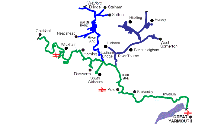
The Northern Broads (Bure, Ant & Thurne)

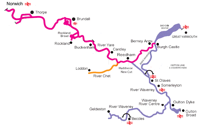
The Southern Broads
(Yare, Waveney & Chet)


